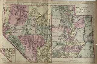
County and Township Map of Utah and Nevada
Philadelphia: S. Augustus Mitchell, 1881. Map [35 cm x 55 cm] on a single sheet [38.5 cm x 59 cm]. The territorial [Utah] and state [Nevada] boundaries and the counties within each have been hand tinted Colors are bright. Vertical centerfold as issued. Splitting at the foot of the centerfold..... More