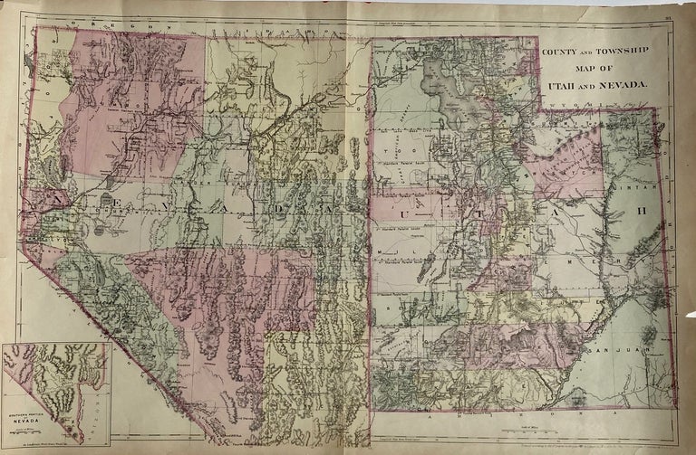
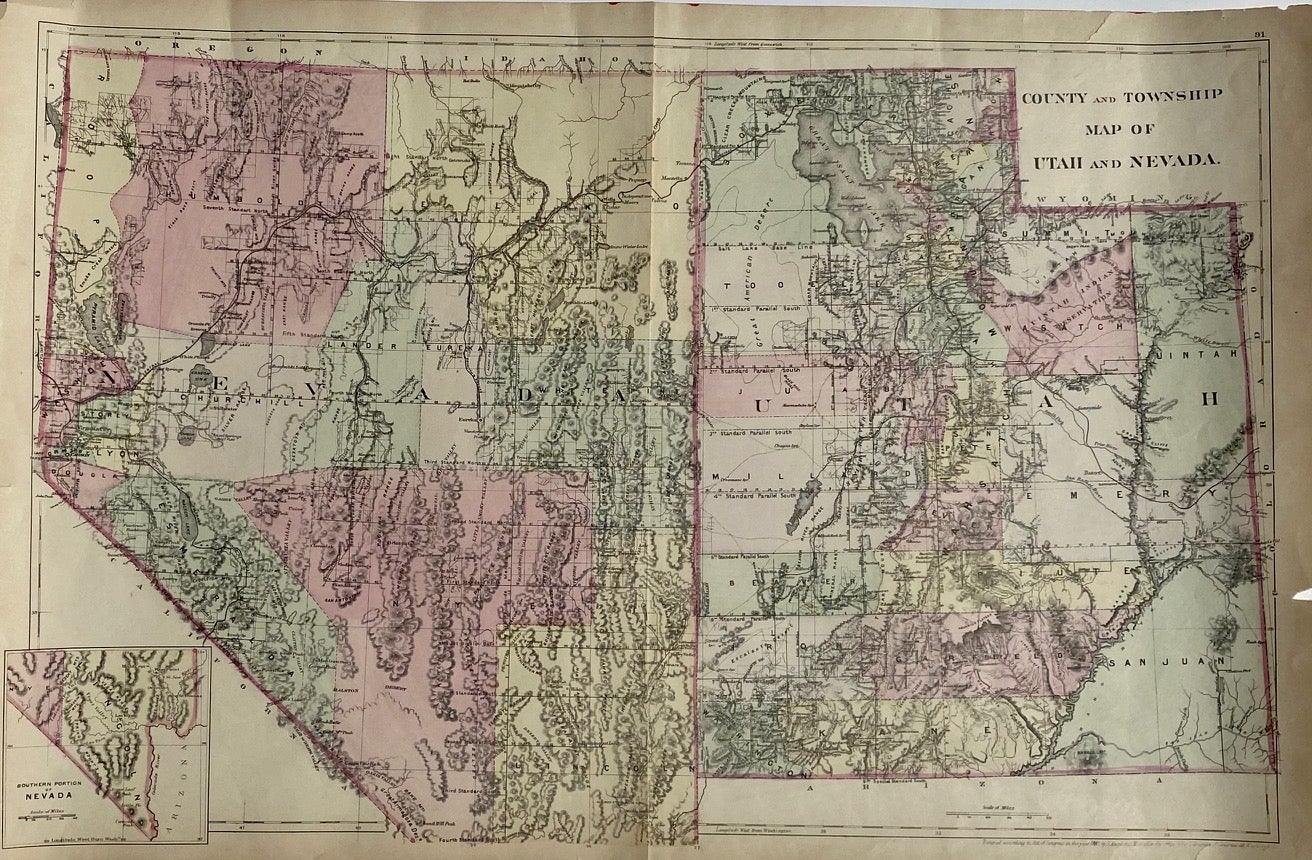
County and Township Map of Utah and Nevada
Philadelphia: S. Augustus Mitchell, 1881. Map [35 cm x 55 cm] on a single sheet [38.5 cm x 59 cm]. The territorial [Utah] and state [Nevada] boundaries and the counties within each have been hand tinted Colors are bright. Vertical centerfold as issued. Splitting at the foot of the centerfold. A few small chips and age toning to extremities. Item #4321
Detailed map that shows roads, township lines and railroads to Eureka [NV], Austin, Juab, Stockton, Alta, Bingham and Frisco as well as showing the U.P and D&RG. Nephi is labeled 'Salt Creek.' Inset map of the southern tip of Nevada. From Mitchell's New General Atlas. Moffat 166. Phillips 895.
Price: $75.00
See all items in
Map
See all items by S. Augustus Mitchell