
Animated North America
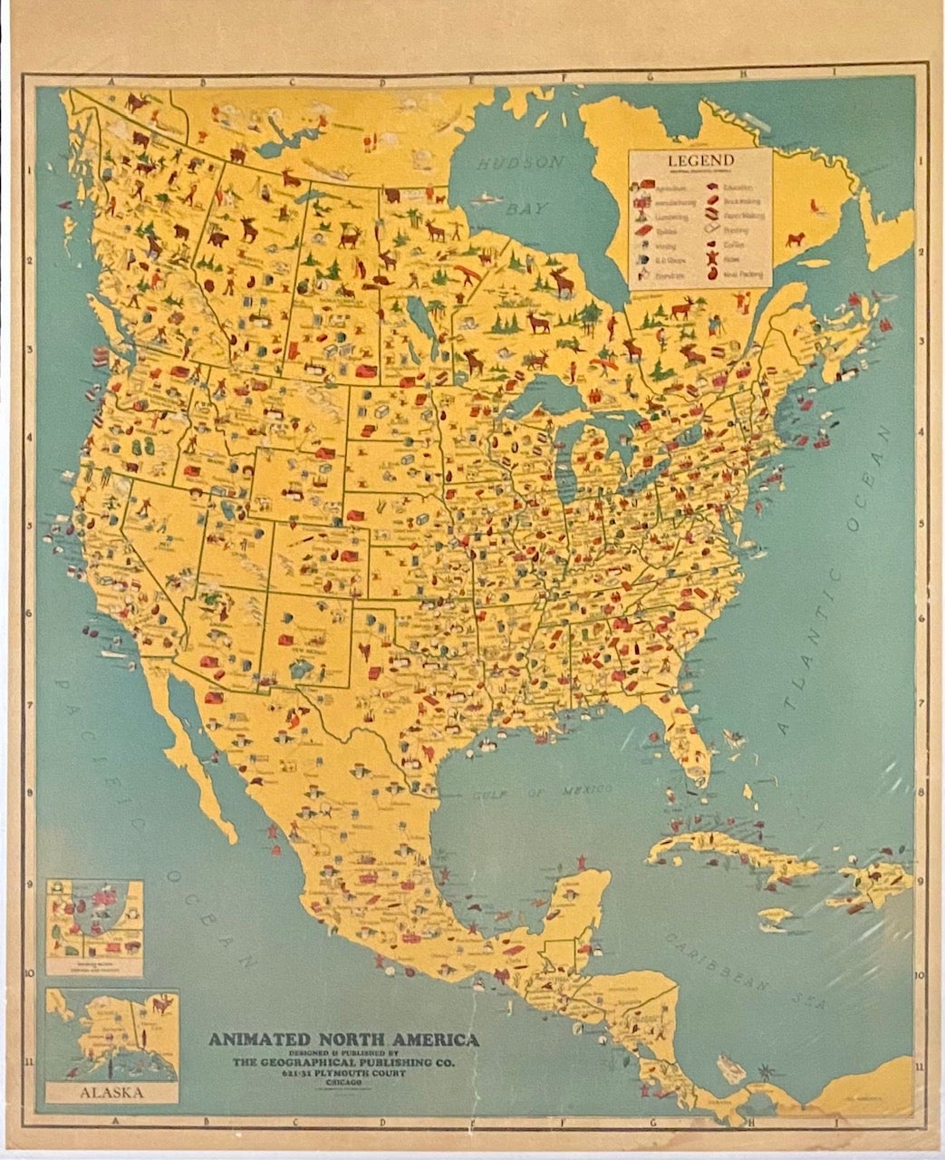
Chicago: The Geographical Publishing Co, 1930. Pictorial map [86 cm x 69 cm] / [34" x 27"] on a single sheet that has been tissue backed. Minor wear. Item #7302
Charming map that shows principal industries for North America that are located with symbols. Legend lists: Agriculture, Education, Manufacturing, Brick Making, Lumbering, Paper Making, Textiles, Printing, Mining, Coffee, R.R. Shops, Hides, Foundries, Meat Packing. Inset maps at lower left for 'Chicago and Vicinity' and Alaska.
Price: $75.00
See all items in
Americana
See all items by Pictorial Map