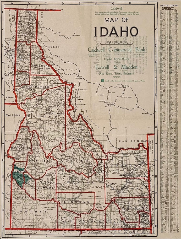
Map of Idaho
[Denver]: The Clason Map Co., Advertising and Reference Maps], 1907. Single sheet [53 cm x 40 cm] / [24" x 16"] that folds to pamphlet size [20.5 cm x 11 cm] Better than very good. Item #6506
Promotional land map of Idaho, with a focus on Caldwell, Idaho: 'The center of the Payette-Boise Government Irrigation Project is in the midst of the finest body of Irrigated Land in the West.' This featured area is colored green. List of towns and locating coordinates printed at the right. County boundaries in red, railroad lines located.
"Post This Map. Things are doing and you are going to hear from Idaho. You Will Need It. We are going to give you this 25c corrected map of Idaho in order that you may make yourself familiar with the richest of the Intermountain States and especially with the great irrigated area now opening under Government Irrigation and of which Caldwell is the center. For information as to Savings Deposits, Investments, Farm Loans, Farm Lands or City Property address. Caldwell Commercial Bank or Lowell & Madden." from the reverse.
We are unable to locate any institutional holdings for this map. Rare.
Price: $275.00