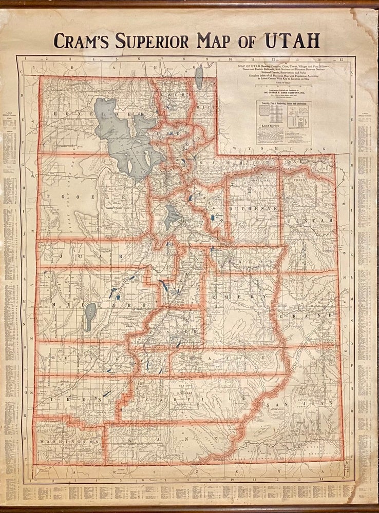
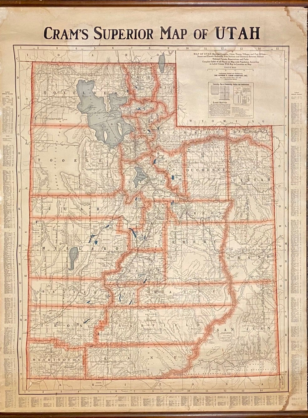
Cram's Superior Map of Utah
Indianapolis: The George F. Cram Company, Inc., (c.1940). Map [114 cm x 89.5 cm] / [45" x 35"] on a linen-backed sheet between wooden rollers at the head and foot. Map is bright with minor wear and to the left and right edge and a faint damp stain at the right corners (does not affect the map). Colors are bright. Item #4623
Nice large wall map that is highly detailed and shows the county boundaries in a light red and the bodies of water located in light blue. Index of all cities and towns printed in the left, right, and lower border with population numbers from the census. Legend at upper right.
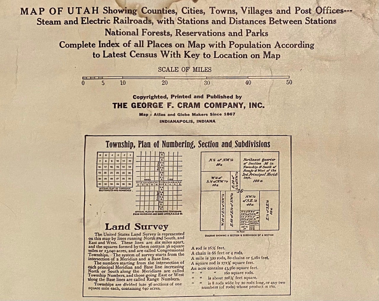
Subtitle: 'Map of Utah showing counties, cities towns, villages, and post offices - Steam and electric railroads, with stations and distances between stations. National Forests, reservations, and parks. Complete index of all places on map with population according to latest census with key to location on map.'.
Price: $350.00