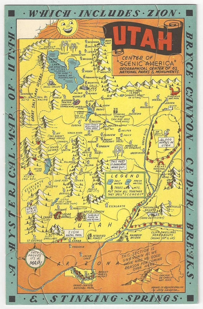
A Hysterical Map of Utah - Which Includes Zion, Bryce Canyon, Cedar Breaks and Stinking Springs
Spokane, WA: Lindgren-Turner Co., (c.1940). Illustrated map jigsaw puzzle [23 cm x 15 cm] printed in color in original printed mailing envelope. Puzzle is bright and in nice condition. Envelope shows minor sunning and extremities. Item #2974
Charming illustrated map of Utah that locates town, parks, mountains, lakes, etc. This is not something that we have encountered previously. "Drawn in Broken English by Jolly Lindgren". Not in OCLC. Not in Rumsey.
The Lindgren brothers of Spokane, Washington, were commercial sign makers through the 1920s, as the economic depression of the 1930s took hold in the once prosperous Pacific Northwest, Jolly Lindgren began drawing maps of western National Parks (Yosemite, Yellowstone, Zion, Bryce, Grand Canyon, Rocky Mountain and others) sites and towns (Death Valley, Grand Coulee, Lake Tahoe, Jackson Hole, Black Hills, Puget Sound, Palm Springs) and western states (Washington, Oregon, Montana, California, Utah and likely others). These whimsical maps were named 'Hysterical Maps' and included many jokes and puns. These maps proved to be quite successful and were produced through the 1940s.
Price: $150.00