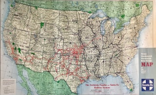
Trans-Continental Territorial Rate Map of the United States. Santa Fe
Chicago: Rand McNally & Company, (c.1950). Color map [48.5 cm x 80 cm] on a single sheet [51 cm x 81 cm] Light overall wear. Very good. Map shows the routes of The Atchison, Topeka and Santa Fe Railway System. The reverse is blank. The Kolob section of Zion NP..... More